Emigrant Lake
I never thought I'd ever make a day trip into Emigrant Lake but that's exactly what happened. Definitely not by design but the weather wasn't in my favor. I'd been watching the weather pretty closely because I been forced to push my original departure date back several times. The forecast was sketchy- slight chance of storms on my departure date, clearing the next day and then getting progressively worse for the remainder of my trip. 7 days in total with only one good day forecast. I decided to risk it. It would be my only window for a long trip before the end of the year.
I did the "death march," so called by my friend's girlfriend, from Kennedy Meadows to Sheep Camp in pretty good time and got to Lunch Meadow in mid afternoon. (It's a 7 mile hike that can be hot and dry and covers 1,500 feet of elevation gain in 3 miles.) I was pleased. The afternoon thunderstorms came in just as I was about to make the last push from Lunch Meadow to the base of Brown Bear Pass but I had expected this. My planned destination for the first night was High Emigrant Lake but I was prepared to spend the night at Lunch Meadow if I had to. High Emigrant Lake is stark with little protection from the elements. It resides in a low spot between Emigrant Pass and Brown Bear Pass and acts as the thunderstorm super highway. Spending the night there during good weather would be amazing but during a thunderstorm, not so much.
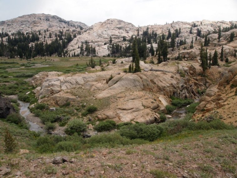
Low water on Summit Creek at Lunch Meadow. About 10 min after this picture the sky turned dark, the rain came down and lightning flashed across the sky.....
The storm was almost directly overhead so I decided to wait it out a bit in Lunch Meadow. After about an hour I got antsy. It was too early in the afternoon to make camp and hang out in my tent while the sky boomed and the rain fell. The lightning strikes were a bit farther apart so I decided to continue on and at least get a view of what was going on at the pass. Perhaps the worst was over and the pass would be clearing. Nope. As I approached the intersection that lead to either Brown Bear Pass or Mosquito Pass, I could clearly see that the storm was coming from Brown Bear Pass.
I stopped to weigh my options. Trying to head over Brown Bear Pass certainly wasn't an option but sheltering over night at it's base or even in the canyon of Lunch Meadow wasn't appealing either. I just imagined the storm clouds coming over the pass and lingering in that canyon all night. I looked up the trail toward Brown Bear Pass and then over toward Mosquito Pass. The weather over Mosquito Pass looked slightly better. Mosquito is about 500 feet lower than Brown Bear Pass but you're at that elevation longer as it's high plateau. Then I realized that in 3 trips to Emigrant Lake, I've never had bad weather there, despite what was going on around the Emigrant. I also realized that I could simply reverse the route that I had originally decided on and fish Emigrant Lake first and High Emigrant Last. I decided to risk going over Mosquito Pass in the storm and make my first nights camp Emigrant Lake.
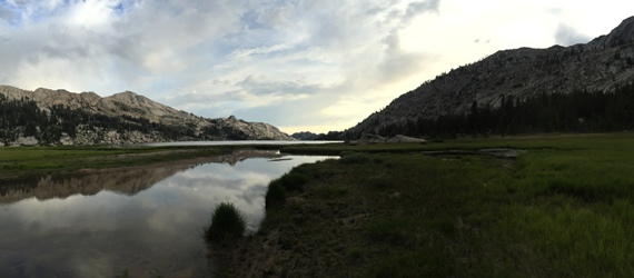
My favorite campsite at Emigrant Lake
I had a rough night at Emigrant with very little sleep. The thunderstorms started to intensify around 8 pm and I was witness to a pretty spectacular light show until around midnight. During this time the wind was slowly building until it was so fierce that I wondered if my tent would survive the night. Wind, rain and sand battered the tent until just before dawn. (Next trip I'm bringing ear plugs.....)
I was up early so I ate and hit the water. The sun was low and the glare made it difficult to see into the water. The night before I'd done some cursory scouting. The lake was low and the flooded grass that I rely on to hold fish wasn't flooded.
I didn't let this deter me and I stalked the shallow flats near the inlet of Cherry Creek. There is more grassland on the lake than the small patch that I usually fish, so I waded in and made my way through it. On the trail side of the lake, the grass can be easily accessed from the bank. It floods and becomes a bit marshy but there's really no wading involved. On the opposite side of the creek it's a different matter. The bank is lined with tall grasses and channels to about 30 feet out from shore. Good fish holding water but requires deep wading in some cases to reach. I waded through the grass but unfortunately, my timing was a bit off. The sun was too low for me to see effectively and I was pushing fish out ahead of me. I fished the grass for a while before turning my attention to the creek. I've caught some good fish in the creek but this trip those fish seemed to be far and few between.
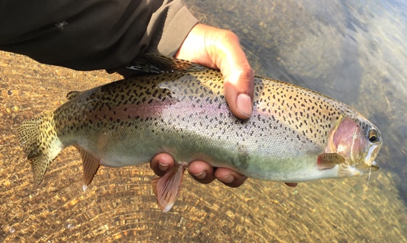
Walking up the bank I found plenty of 6 to 8 inch fish but nothing worth casting to, at least not worth casting to, given the potential size of fish on this lake. Finally I happened on a group of rocks in some deeper water and a decent fish showed itself. It was pretty well sheltered among a group of 4 or 5 rocks all between basketball an beach ball size. It was moving about but not revealing all of it's body. I tried to drift a nymph among the rocks but the current wasn't right and would always push the fly to the outer edge, away from the fish. I pulled the fly out of the water and dapped it along the edge of the closet rock. The fish shot out and I set the hook. It gave up a pretty good struggle before coming to hand, diving for the safety of the roots along the undercut bank.
I fished for about 2 hours before heading back to camp. That morning I had the intention of fishing for a few hours and then reassessing the weather. At first, the weather looked good but as the sun rose higher in the sky, the skies grew darker. Again, I knew the forecast. This day was supposed to be the best day out of the 7 and already it looked worse than the day before. It was still early enough in the day that I figured that I could hike the 15 miles back to the car before dark.
I reached Sheep Camp at about 12:30pm. Sheep Camp is roughly the half way point in the trip and I hadn't been paying much attention to the sky behind me as I made my descent. Just below Sheep Camp I spoke with a couple that was hiking up to Emigrant Lake. I'd seen a packer taking their gear in as I crested Mosquito Pass and they asked for an update on the trail, the packer and the weather. When I remarked about how the thunderstorms had come in about 1:30 or 2:00 pm, the fellow said, "It looks like they're coming in earlier today."
I turned around to find a big black cloud at my back. From there it was a race back to the trailhead. A race that I lost, my chief concern was getting down the granite bluff just after Saucer Meadow before the storm caught up with me. It's steep, slippery and exposed. Just as I entered the dense forest at it's base, I ran into another couple. This couple had full packs and was somewhat lost, thinking they'd missed the turn to Relief Valley.
"Its about to get ugly" I said as I passed them.
They stopped me to ask about the trail and possible camping alternatives.
"The trail ascends up steep granite for another mile or so before it flattens out a bit. You might be able to find some camp sites there but the best one is at Sheep Camp, another two miles up the trail." I said.
They looked a bit concerned. At this point the women did most of the talking. She seemed to be the one "in the know". Just as I was about to take my leave, the fellow asked me if I knew where the trail junction was. I happily explained to them that if they were going to Relief Valley, the trail junction was only about 10 minutes up the trail and that they could find a campsite there.
I took my leave. I'd managed to get to the lower elevation near the reservoir but would still have one fairly exposed pitch along the reservoir before heading down to Kennedy Meadows.
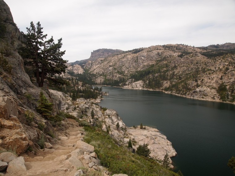
Relief Reservoir, taken on the way in.
I charged up the bluff along Relief Reservoir as quickly as I could. Lighting had already started crackling along the peaks around me. I was amazed at how many people where making the climb up the canyon from Kennedy Meadows in the storm and even more surprised by how many more people where standing around Kennedy Meadows watching the storm when I finished my descent. The storm chased me all the way down to the trailhead and standing outside the Kennedy Meadows store, I counted the time between the lightning flashes and thunder at 1 second! (In this case, that's about a 1000 feet, meaning the storm was essentially right on top of us.)
"Don't mind me folks. Astraphobic passing through. Enjoy your storm."
I still had 5 days worth of backpacking food in my pack so I decided to head south for better weather. The drive over Sonora Pass took me through the heart of the storm. Lighting bolts flashed and crackled around my car until I reached the summit. Once over the summit, evidence of flash floods was seen in many washed out portions of the road. As I made my way off of Sonora Pass to Mammoth Lakes and then down to Long Pine to fish the Cottonwood Lakes I was amazed to see that the Sierra was engulfed in what was essentially one huge, dense storm cloud. It looked beyond ugly up there....
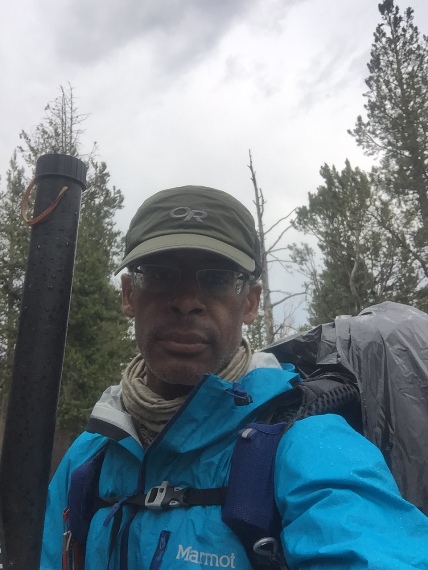
Rain gear city!